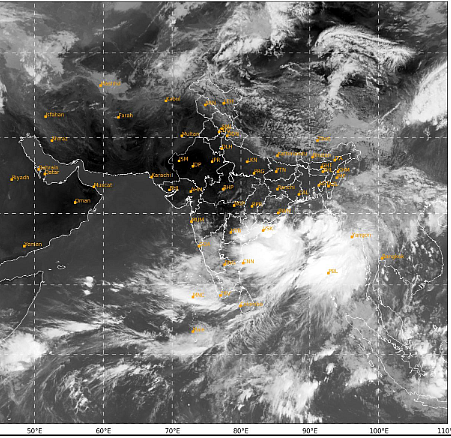
Cyclone Remal, a severe cyclonic storm, has formed over the Bay of Bengal and is likely to make landfall between West Bengal and Bangladesh coasts on Sunday midnight, the India meteorological Department (IMD) said.
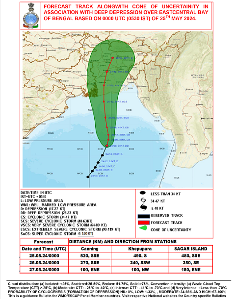
The landfall is expected to be made between West Bengal's Sagar Island and Bangladesh's Khepupara.
The weather department has issued alerts for extremely heavy rainfall on May 26 and 27 for the coastal districts of West Bengal and northern Odisha. Authorities have asked the state governments to take precautionary measures, directing fishermen to return and not venture into the sea.
A cyclone, by definition, is a storm or system of winds that rotates about a centre of low atmospheric pressure, advancing at a speed of 20 to 30 miles (30 to 50 kilometres) an hour, often accompanied by significant rainfall.
PATH AND TRACK:
The severe cyclonic storm "Remal" over the north Bay of Bengal moved nearly northwards with a speed of 13 Kmph during the past six hours and lay centered at 6:00 UTC on May 26, over the same region about 220 km south-south west of Khepupara (Bangladesh), 260 km south of Mongla (Bangladesh), 210 km south east of Sagar Islands (West Bengal and 230 km south-south east of Canning. Currently, with a maximum sustained wind speed of 95-105 Kmph gusting to 115 Kmph, the storm prevails around the cyclone centre, IMD's latest bulletin read.


It is very likely to continue to move nearly northwards, further intensify and cross Bangladesh and adjoining West Bengal coasts between Sagar Island and Khepupara, close to south west of Mongla (Bangladesh) by 18:00 UTC (11:30 PM IST) on May 26, as a severe cyclonic storm with maximum sustained wind speed of 110-120 Kmph gusting to 135 Kmph.
FISHERMEN WARNING
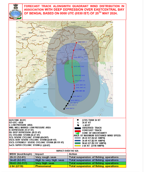
Issuing a warning to the fishermen, the Met office advised them to not venture into the South Bay of Bengal and Andaman Sea till May 27, Central Bay of Bengal till May 26 and North Bay of Bengal from May 25 to May 27. "Fishermen are advised to return to the coast," IMD said.

The Met office also posted a graphic representation of the Cyclone Remal's storm surge warning.

RAINFALL WARNING
The IMD has said that light to moderate rainfall is expected at most places with heavy to very heavy rainfall at isolated places over coastal districts of West Bengal on May 26 and 27. While isolated extremely heavy rainfall over the coastal districts on May 26.
The Met office said isolated heavy rainfall is likely over North Coastal Odisha on May 25 and 26.
Light to moderate rainfall at most places with heavy to very heavy rainfall in isolated pockets is likely over eastern districts of Sub-Himalayan West Bengal on May 27 and 28.
Additionally, isolated extremely heavy rainfall is also likely over Assam and Meghalaya on May 27 and 28, Arunachal Pradesh on May 28 and Tripura on May 27.