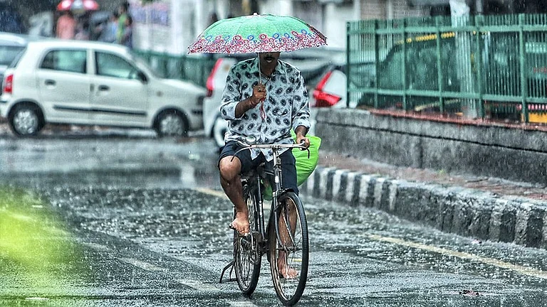
Mumbai woke up to light to moderate rainfall this Monday morning, marking the return of monsoon activity after a brief respite over the weekend. The India Meteorological Department (IMD) has issued a yellow alert for the city, with heavier rainfall expected in the coming days.
Current Weather Conditions
The metropolis is currently experiencing generally cloudy skies with intermittent showers across the city and suburbs. According to the IMD's official weather station, Mumbai recorded a minimum temperature of 26 degrees Celsius and a maximum of 29 degrees Celsius. The humidity levels remain high at 81-89%, with wind speeds recorded at 9.5 km/h from the southwest direction.
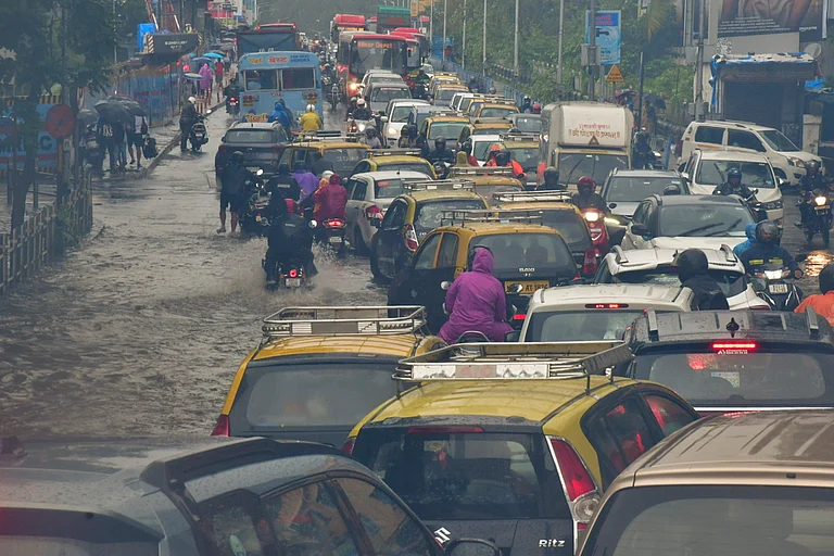
As of Monday morning, average rainfall recorded between 8:00 AM on August 24 and 7:00 AM on August 25 was 12.41 mm in the City, 13.84 mm in the Eastern Suburbs, and 18.04 mm in the Western Suburbs. The BMC has confirmed that early morning showers have caused waterlogging in Sion's Gandhi Market area and parts of the Eastern Express Highway.

IMD Weather Alert and Forecast
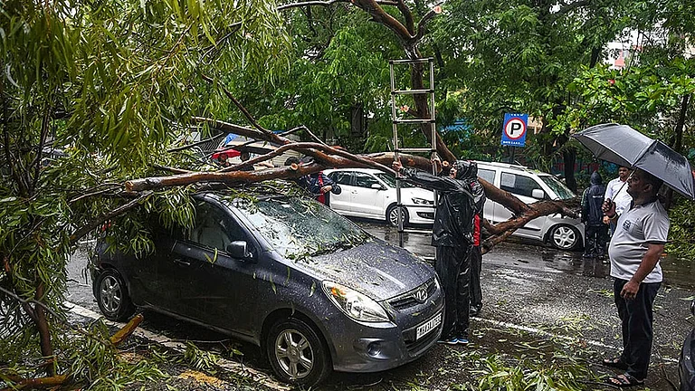
The IMD has issued a yellow alert for Tuesday and Wednesday, warning of heavy to very heavy rainfall across Mumbai and neighboring districts, including Thane, Raigad, and Palghar. The weather department predicts that rainfall intensity will peak on August 26 and 27, coinciding with the beginning of Ganesh festival celebrations.
Today's forecast indicates light to moderate rain with temperatures hovering between 27 to 31 degrees Celsius. Wind speeds are expected to remain at 25-30 km/h, with stronger gusts likely near the coastal areas. The monsoon trough continues to influence weather patterns, with a fresh low-pressure area expected to develop over the Bay of Bengal around August 25.
Mumbai High Tide Alert and Timing
The Brihanmumbai Municipal Corporation (BMC) has issued a high tide alert for Monday. The tide schedule shows high tide at 1:16 PM reaching 14.6 feet (4.45 meters), followed by low tide at 7:31 PM at 2.99 feet. The midnight high tide is expected at 1:33 AM on August 26 at 4.14 meters.
These high tide timings are crucial as they can exacerbate waterlogging conditions when combined with heavy rainfall, particularly affecting low-lying areas and coastal roads.

Transportation Impact
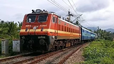
Mumbai local train services are currently running normally on both Central and Western Railway lines, though authorities have advised commuters to check live updates before traveling. The city's transportation network remains on high alert following recent disruptions caused by track submergence and waterlogging during previous heavy rainfall episodes.
Traffic advisories have been issued for key routes, with authorities recommending travelers to avoid flooded stretches and stick to well-drained main roads. The Mumbai Metro is being suggested as an alternative for certain routes.
Extended Weather Outlook
The IMD forecast indicates that rainy conditions will persist through the week, with moderate to heavy showers expected until August 29. Areas such as Borivali, Andheri, Powai, and Bandra are likely to remain mostly dry with only occasional passing showers, while Central Line areas, including Sion, Chembur, Ghatkopar, and Mulund, remain under yellow alert.
Private forecaster Skymet Weather has warned that the upcoming weather system may dump over 100mm of rain in 24 hours on certain days, with activity peaking during the Ganesh festival period. The rainfall is expected to taper off gradually by August 28.
Residents are advised to stay updated with official IMD bulletins and avoid unnecessary travel during peak rainfall hours. The BMC continues to monitor the situation closely, with all emergency services on standby to handle any monsoon-related disruptions.
For real-time updates on Mumbai weather and rain alerts, citizens can check the official IMD website at mausam.imd.gov.in and follow BMC's official social media channels for local advisories and traffic updates.