In Kashmir, a seemingly serene and wide flood spill channel carries a dual identity - a guardian of lives and livelihoods in the capital city of Srinagar during floods, while offering its lush green expanse for recreational activities and leisure during the dry spells.
The flood spill channel serves as a playground for cricket, football, and running. Every day, men and women can be seen running and walking along its banks, armed with sticks to deter stray dogs. However, when the river exceeds its danger level, the 48 km long flood spill channel, stretching from Srinagar to the enchanting Wullar Lake, becomes the lifeline of the Valley.
It plays a vital role in flood management by diverting excess water from the Jhelum, which originates in South Kashmir and weaves through Srinagar before entering into Wular Lake, a natural absorber of excess water in Kashmir.
In the early 20th century, Maharaja Pratap Singh constructed a flood spill channel to redirect the surplus floodwater from the river to the low-lying wetlands of Batamaloo and Hokarsar. The low-lying areas are no longer wetlands; they have now become vast urban centres, indicating the ever-expanding Srinagar city.
One of the significant flood control measures was the construction of the Flood Spill Channel (FSC) in 1903, following the major flood of 1893. The Flood Spill Channel was designed to handle approximately 17,500 cusecs of water, but due to sedimentation, its current capacity is only about 50% of that.
Officials say in 2009-10, the Irrigation and Flood Control Department had sent Rs 2038 crore project to the Ministry of Water Resources for flood mitigation programme.
Officials say that as the government was aware that a major flood is expected every 100 years, it allocated Rs 100 crore for the dredging of the flood spill channel and other related works.
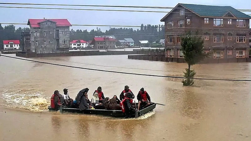
In 2012, according to the Flood Control and Irrigation Department website, the carrying capacity of the Flood Spill Channel was increased from 4000 cusecs to 8000 cusecs through dredging. Then came the devastating floods in September 2014 in Jammu and Kashmir when the embankments of the flood spill channel and Jhelum caved in, submerging Srinagar completely. The floods claimed 300 lives and impacted around two million families. Among the affected population, 1.4 million people lost their household assets and livelihoods, 67,000 houses were fully damaged, and over 66,000 were partially damaged. The government now says during the 2014 floods the carrying capacity of the flood spill channel was just 4000 cusecs.
After the 2014 floods, the Central government approved Rs 2023-crore funding to improve embankments and carry out dredging and other works. The project was funded under the Prime Minister’s Development Package. The central government divided the flood management plan into two phases. It sanctioned around Rs 400 Crore for the first phase.
In phase-I significant focus was on increasing the carrying capacity of the flood spill channel, protection work of the Jhelum bunds, and land compensation.
Last year the Chief Engineer Irrigation and Flood Control Department Naresh Kumar announced that phase I of the flood mitigation project was complete and the embankments of the river Jhelum and the flood spill channel are safe. He also said that dredging of the flood spill channel has been done with 35 lakh cubic meters of sediment has been removed from the channel. The department is planning to take the rest of the excavation in the second phase, he stated. The Chief Engineer also said the carrying capacity of the flood spill channel and the river has been increased.
Officials say the UT government will now commence work on phase II of the project with the remaining Rs 1600 crores, which includes widening the flood spill channel and creating an outfall from the Jhelum into Wullar Lake. The acting Chief Engineer Mohd Salim Malik didn’t pick up the phone for his comment. While Kumar said he was on leave.
According to the PDP-BJP government plan of 2018, the second phase aimed to increase Jhelum's water carrying capacity in South Kashmir to its maximum capacity of 60,000 cusecs and in Srinagar the plan was to increase the water carrying capacity to 35,000 cusecs. The remaining 25,000 cusecs of water were proposed to be diverted through the flood spill channel.
In 2018, former Minister for Works, Naeem Akhtar, says a proposal was to distil the flood spill channel and utilize its mud as filling material for a new highway. He says after the PDP-BJP government was dissolved, the proposal was not implemented. Instead, the government opted to demolish highlands in Budgam and other districts, using its soil for highway and road construction. This disaster could have been avoided, he adds.
According to the National Institute of Disaster Management, Ministry of Home on the evening of September 6 2014, the Sangam station of river Jhelum in South Kashmir shot up to 34.70 ft and began to spill over the river banks. The carrying capacity of Jhelum in Srinagar city was about 35,000 cusecs but on September 6, 2014, the discharge at Sangam recorded about 1,35,000 cusecs which was one of the highest ever recorded, causing 84 breaches due to spill-over, eroding the outer slope of the embankments.
Now the government claims of increasing the water carrying capacity of the Jhelum River and the flood spill channel would only be tested when the water level crosses red alert.


