Hailstorm alert issued for 16 western UP districts with heavy rainfall and 30-50 kmph winds expected today
Western disturbance brings peak weather intensity through October 7 before clearing to pleasant autumn conditions.
Agricultural damage warnings issued; harvesting operations suspended during extreme weather periods
Temperature relief arrives Wednesday with a 4-5°C drop, marking early winter onset across the state.
Current Weather Conditions
UP weather today shows significant changes with light to moderate rainfall across most districts on Monday, October 6, 2025. The state is experiencing comfortable temperatures ranging from 22°C to 34°C with 70% rain probability during evening hours. Early morning conditions reveal partial cloud cover with humidity levels between 59-67% across major cities, including Lucknow, Kanpur, and Varanasi.
The weather in Uttar Pradesh has taken a dramatic turn as the region experiences relief from recent heat and humidity due to western disturbance effects, bringing cooler winds and intermittent showers. This marks the first significant post-monsoon weather activity that promises to bring much-needed respite from oppressive conditions.
Hailstorm Alert Grips Western Districts
The India Meteorological Department (IMD) has issued a hailstorm alert in UP districts covering 16 western regions with heavy rain and thunderstorms expected throughout the day. A yellow alert in Uttar Pradesh encompasses multiple areas with specific warnings for hailstorms accompanied by heavy rainfall that could cause significant agricultural damage.
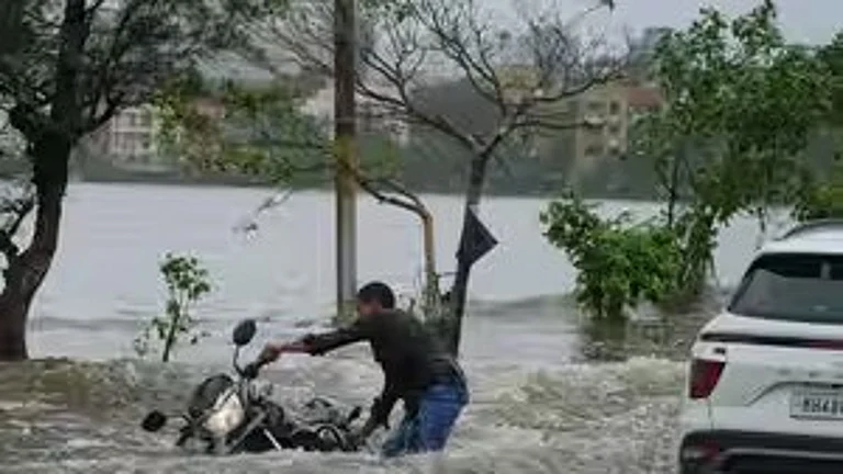
Districts under immediate hailstorm threat include Saharanpur, Shamli, Muzaffarnagar, Bagpat, Meerut, Hapur, Bulandshahr, Aligarh, Bijnor, Amroha, Moradabad, Rampur, Sambhal, Kasganj, and Budaun. These areas face the prospect of heavy rainfall measuring 7-11 cm accompanied by thunderstorms, lightning, and gusty winds reaching 30-50 kmph during peak activity periods.


Regional Impacts
Western UP: Orange to red alerts are in effect. Afternoon thunderstorms with hail could damage ripening crops. Maximum temperatures will reach 33–35°C, dipping to 23–25°C at night.
Central UP: Lucknow, Kanpur, and Prayagraj see moderate rainfall and thunderstorms. Lucknow will experience temperatures of 32–35°C by day and 22–26°C at night, with a 44% chance of rain.
Eastern UP: Varanasi, Bhadohi, Ballia, and Azamgarh have received light rain since Sunday. They remain under yellow alerts for isolated heavy spells, with temperatures of 31–35°C and humidity above 80%.
Western Disturbance Dynamics
The current weather results from a western disturbance originating over the Mediterranean, drawing moisture from the Arabian Sea and Bay of Bengal. It has caused widespread cloud cover, heavy showers, and cooler northwesterly winds. Peak intensity is forecast for October 6–7, after which conditions will gradually improve.

Safety and Agriculture
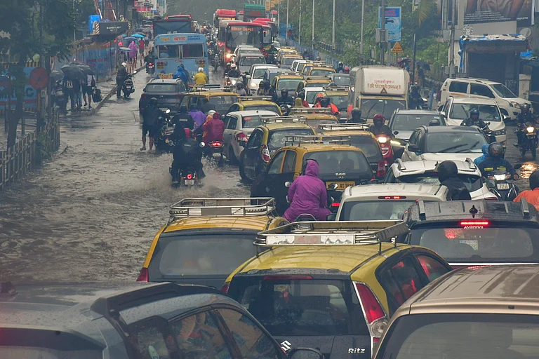
Residents should avoid outdoor activities during thunderstorms, stay clear of trees and power lines, and prepare for traffic disruptions on waterlogged roads. Farmers are advised to protect ripening crops, secure livestock, and postpone harvest operations until the weather improves.
This significant post-monsoon weather event provides much-needed relief from the recent heat wave while introducing early winter-like conditions across Uttar Pradesh.