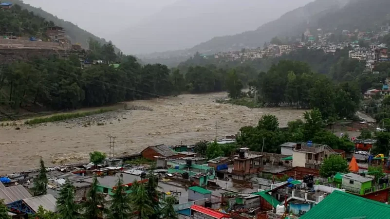
The experts are linking the devastating deluge in north India parts from past two days to “deadly” union of two weather systems.
They opine the two systems the monsoon winds and a western disturbance are similar to the interaction of two systems that led to the deadly Uttarakhand flooding in 2013.
“Such interactions are increasingly likely to cause extreme rain and flooding in a warming world,” the TOI report said.
The distressing videos of damages caused by gushing waters of rivers flowing over danger mark in north India especially Himachal Pradesh’s Manali are all over social media.
The haunting images and videos of vehicles parked along the Beas river being carried off by flash floods in Kullu in Himachal Pradesh, is all over the social media.
Meanwhile, the Delhi government has issued a flood warning, after Haryana had released more than 1,00,000 cusecs of water into the Yamuna from two spots.
Heavy rains in Himachal Pradesh have caused devastating landslides and flash floods, resulting in the loss of at least five lives and the blockage of hundreds of roads, including three national highways.
Over the past two days, two weather systems have been active over north India.
"There was a trough extending from Rajasthan to north Arabian Sea associated with a western disturbance. At the same time, due to strong monsoon conditions, the winds from Bay of Bengal were also reaching the north. There was a confluence of these two systems, centred around Jammu & Kashmir on Saturday and around Himachal Pradesh on Sunday. These areas got moisture from both Arabian Sea and Bay of Bengal, resulting in very heavy showers," said the TOI report quoted IMD chief Mrutyunjay Mohapatra as having said.
He added such interactions between two weather systems aren't uncommon and have been associated with extreme weather events, particularly in the hills of northwest India.
“In mid-June of 2013, a western disturbance sucked moisture towards the north from a low-pressure system coming in from the Bay of Bengal. This not only resulted in the monsoon covering the entire country in record time (by June 16) but also caused cataclysmic downpours in Uttarakhand, including the cloudburst at Kedarnath,” he said.
"The mountains get a lot of rain from such two-system confluences because the winds hit the hills and rise, causing heavy precipitation," Mohapatra said.
Kieran M R Hunt, from the UK's University of Reading, who was the lead author of a study on such two-weather interactions in India as per TOI report said that the intensity of rainfall caused by these confluences could increase in a warming world.
"It is hard to say whether the frequency (of such interactions) will go up or down because there's no clear trend. We can be fairly certain, though, that these interactions, when they do happen, will be increasingly linked with extreme rainfall and flooding," Hunt was quoted as having said.


