Fine particulate matter (PM) concentrations above Delhi may be far higher than what ground stations capture, with drone observations showing levels at 100 metres rising by as much as 60% compared with those at the surface.
The results come from an international field campaign led by scientists from the Leibniz Institute for Tropospheric Research, now working at TU Delft. Published in npj Clean Air, the study ‘Drone Measurements Reveal High Near-surface Urban Haze’ argues that without high-resolution vertical measurements, authorities risk missing a significant share of the pollution burden, especially during intense morning haze.
While satellites and fixed monitors form the backbone of urban air surveillance, they provide limited insight into how pollutants are layered in the lowest part of the atmosphere. Yet it is precisely this vertical structure that determines how emissions accumulate overnight and how quickly they disperse after sunrise.
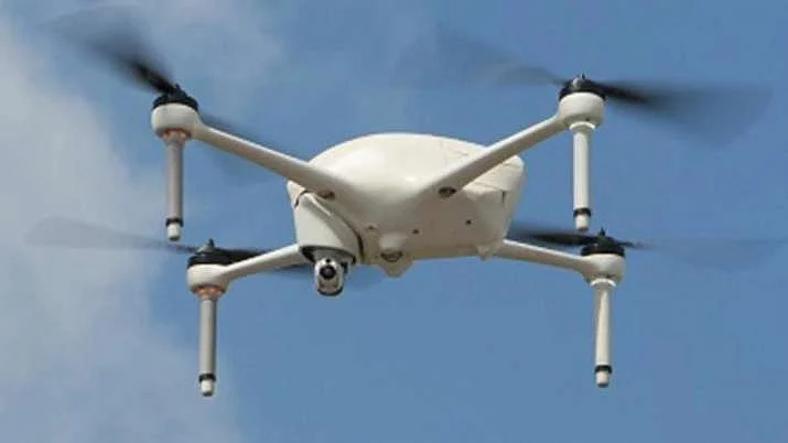
To probe this gap, researchers flew instrumented drones over the campus of the Indian Institute of Technology (IIT) Delhi, comparing readings with reference-grade equipment on the ground. Special modifications were made to reduce interference from rotor turbulence, and a drying system helped maintain accuracy in Delhi’s characteristically humid conditions.
The flights captured a striking daily rhythm. Overnight, relative humidity often exceeded 80%, creating favourable conditions for chemical reactions that enlarge particles and generate secondary aerosols. PM2.5 rose steadily through the evening and early morning, in some instances nearly doubling by daybreak, said the study led by Ajit Ahlawat, from the Department of Geoscience and Remote Sensing, Delft University of Technology (TU Delft), Delft, The Netherlands, and Leibniz Institute for Tropospheric Research (TROPOS), Germany.


As sunlight strengthened, the atmosphere began to mix. Higher temperatures, a drop in humidity, and the expansion of the boundary layer diluted pollutants, leading to a noticeable easing of haze.
Chemical analysis suggested that organics were more dominant during the day, while nitrates, chlorides, and ammonium increased at night—a pattern consistent with emissions from vehicles, industry, and combustion of biomass or waste under stagnant air, as per the study.
When the team compared these real-world measurements with simulations from the widely used WRF-Chem forecasting model, they found that the system frequently underestimated PM2.5 during severe morning episodes. Researchers suspect that limitations in representing moisture-driven particle growth may be partly responsible.
The message, the scientists said, is not that existing systems are ineffective, but that they are incomplete. “Integrating drone profiles with surface networks and satellite retrievals could deliver a far more realistic three-dimensional picture of urban air,” said the study.
Such information would refine exposure estimates for millions living in high-rise housing, guide emergency responses when pollution spikes, and strengthen long-term mitigation strategies.
For megacities where installing tall monitoring towers everywhere is unfeasible, mobile platforms may offer a practical way forward—lifting the lens on air pollution from the street to the sky, as per the study.
When asked to comment, Aakash Sinha, Founder of Delhi-based Omnipresent Robot Technology Pvt Ltd, who was not associated with the study, said that it is a significant observation “because accurate measurement of air pollution forms the foundation of both public health understanding and policy action.”
Mounting low-cost sensors on drones can help bridge major gaps left by stationary monitoring stations. Fixed monitors cannot be installed everywhere, especially in dense urban pockets or remote regions. Drones, on the other hand, can gather data across large areas in a short time. They can record how particulate matter (PM) levels change from one locality to another and, importantly, how pollution varies with height, he said, echoing the authors’ views.
This vertical dimension is crucial. In modern cities, a large number of people live in multi-storey buildings, and pollution at ground level may not be identical to what residents are exposed to on the tenth or twentieth floor. Drones provide a practical way to understand these differences, making exposure assessments far more realistic, Sinha added.
Another advantage is rapid response. If pollution spikes in a particular area due to an industrial release, construction activity, or a fire, drones can be deployed quickly to provide near real-time data, enabling authorities to act faster, said Sinha, whose company has been associated with the Government’s house mapping programme “Svamitva” under the Union Panchayati Raj Ministry in over a dozen States among a few other projects.