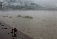
The 2026 Assam floods deviated from the state's typical pattern: instead of the Brahmaputra overflowing, excessive upstream rainfall was the primary cause.
Assam's embankment network totals over 4,900 km but many structures have exceeded their designed lifespan.
Erosion is a separate and in some ways more permanent crisis than flooding.
Every year, when the monsoon arrives, Assam floods. This has been true for as long as anyone in the state can remember, and it was true long before human settlement made it a crisis. The Brahmaputra and its more than 50 tributaries are the life of the Assam plains — sustaining agriculture, recharging wetlands, and maintaining one of the world's richest floodplain ecosystems. The problem is that Assam has, over seventy years of flood-control effort, built itself into a state where the system's natural functioning has become incompatible with the settlements, infrastructure, and expectations placed upon the floodplain.
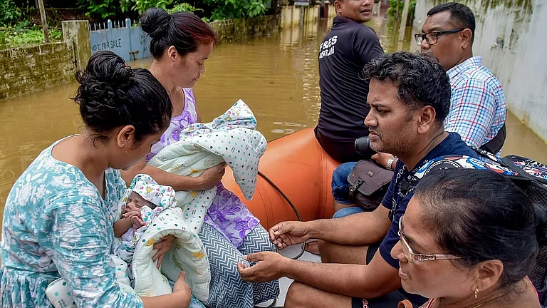
The July 2026 floods in Assam once again brought widespread inundation, damaged public infrastructure, displaced thousands of residents and disrupted livelihoods across several districts.

Why The Brahmaputra Defies Conventional Flood Control
The Brahmaputra is not a river that can be tamed through engineering in any conventional sense. The Brahmaputra carries enormous quantities of sediment from the Himalayas. After entering the Assam plains near Pasighat, the river's slope becomes gentler, reducing its ability to carry sand and silt. This sediment settles on the riverbed, reducing its water-carrying capacity and pushing water towards surrounding floodplains.




The 2026 floods exposed a pattern that researchers have been documenting, the threat is no longer only the Brahmaputra itself. The 2026 floods were caused due to excessive upstream rainfall in Nagaland and Arunachal Pradesh and quick rising of south bank tributaries in association with climate variability. The south-bank tributaries — the Dikhow, Disang, Janji, and Dhansiri — swelled rapidly crossing the danger mark, and water overflowed from embankments before the Brahmaputra hit its peak flood discharge point.
The Limits Of Embankment-Led Policy
India's National Policy on Floods of 1954 recommended embankments as the primary flood mitigation instrument for Assam. In the seven decades since, Assam has built over 4,900 km of embankments along the Brahmaputra and its tributaries, the longest embankment network in any Indian state relative to its size. The policy logic was straightforward: contain the river within banks, protect agricultural land, allow settlement of the floodplain.
Many embankments built decades ago have exceeded their intended lifespan and have weakened or breached under the force of floodwaters. When these structures fail, water can rapidly inundate low-lying villages and towns.
The deeper problem with embankment-led policy is that it creates a false sense of security that drives further settlement of flood-prone land — which then raises the human cost when embankments inevitably fail, which pressures governments to build more embankments, which allows further settlement. The cycle is self-perpetuating.
How Erosion Is Reshaping Assam's Landscape
Flooding is seasonal. Erosion is permanent. This distinction is central to understanding Assam's dual crisis, and it is a distinction that policy has historically failed to make. The width of the Brahmaputra has increased up to 15 km at some places due to bank erosion. Land that has been eroded does not return. Villages that have fallen into the river are gone. The people who lived on that land are not flood victims who can return after the waters recede, they are permanent climate refugees.
The Ecological Cost Of Losing Wetlands
Assam's wetlands — beels, floodplain lakes, and riverine marshes — are the natural flood buffer the Brahmaputra system uses to absorb excess discharge during peak monsoon. When those wetlands are drained, encroached, or converted for agriculture and settlement, the river has nowhere to go during floods except onto the land that replaced them. The Panidihing Bird Sanctuary in Sivasagar district was a wetland where the Brahmaputra, Desang, and Demow rivers created a unique hydrological regime.
Wetland restoration is consistently recommended in expert reports and consistently underfunded in state budgets. The economic logic of wetland conversion is visible at the individual level — an encroached beel becomes agricultural land or a housing site. The cost is invisible and diffuse: slightly higher flood levels across a wide area, reduced fish populations, degraded water quality.
Why Floods And Erosion Are Two Different Crises
Flood policy focuses on containment and relief. Erosion policy requires recognition that entire communities need permanent relocation with land rights, livelihood support, and social infrastructure — not a temporary relief camp and a return to land that no longer exists. The development of comprehensive rehabilitation policies for erosion-displaced families whose losses extend far beyond seasonal crop damage is equally important as any engineering intervention.
Currently, Assam has no separate legal or administrative framework for erosion-displaced persons. They are counted as flood-affected in government statistics, which understates the permanence of their loss and obscures the policy response needed.
Can Engineering Alone Control The Brahmaputra?
The honest answer is that the Brahmaputra will flood Assam every monsoon, the question is how much of that flooding is made catastrophic by failed embankments, lost wetlands, increased sediment loads, and settlements on active floodplains. River basin management needs greater emphasis through scientific dredging where appropriate, desiltation of vulnerable tributaries and restoration of wetlands capable of naturally storing excess water.
Ageing embankments require systematic strengthening before each monsoon rather than emergency repairs after breaches occur. Infrastructure planning must incorporate future climate scenarios instead of relying solely on historical rainfall data.
Seventy years of embankment-first policy have made Assam's floodplain more densely settled and more vulnerable, not less. The river has not been controlled; it has been negotiated with, imperfectly and expensively. What Assam needs is not a better embankment policy but a fundamentally different relationship with its rivers, one that accepts seasonal flooding as the Brahmaputra's natural function and builds around that reality rather than against it.