India has standardised 27 locations and features on Arunachal Pradesh’s official map.
The additions include four passes, 21 locations, a lake and memorial.
Several sites carry strategic significance linked to the India-China frontier and 1962 war.
India has formally updated the official Survey of India map of Arunachal Pradesh to give clearer recognition to 27 locations and geographical features, including mountain passes, settlements, a high-altitude lake and a war memorial.
The exercise was carried out by the Centre in consultation with the Arunachal Pradesh government. Several of the newly standardised locations carry strategic or historical significance, particularly because of their proximity to the India-China frontier and their association with past border confrontations, including the 1962 war.
According to a government press release issued on Friday, the Centre and the Arunachal Pradesh government “identified a total of twenty-seven (27) places/features located in Arunachal Pradesh, by standard place and feature names on the official maps of the Survey of India (SoI).”
The Ministry of Home Affairs said, “Identifying them formally on the Survey of India map of Arunachal Pradesh is aimed at facilitating their accurate recognition and better awareness among the public at large.”
What Has Been Added To The Map?
The updated map formally identifies 27 locations and features across Arunachal Pradesh.
These include four mountain passes: Dzo La, Riza La, Pukur La and Thag La.


One high-altitude lake, Sambho Sarovar, has also been included under its standard Indian name.
Another 21 geographical locations have been formally recorded: Longju, Maja, Bisa, Bara Kundun, Chhota Kundun, Dhan Bari, Pritnagar, Buddhamandir, Jairampur, Teritnagar, Ramnagar, Jaswant Garh, Sagar, Padma, Jyotinagar, Baisakhi, Chhota Ropuk, Bara Ropuk, Shivaji Nagar, Sunpura and Kamlang Nagar.
The Sher-e-Thapa Memorial has also been marked, taking the total to 27.
The government has said the exercise is intended to improve recognition and public awareness of these locations rather than alter India’s existing territorial boundaries.
Why Are Some Of These Locations Significant?
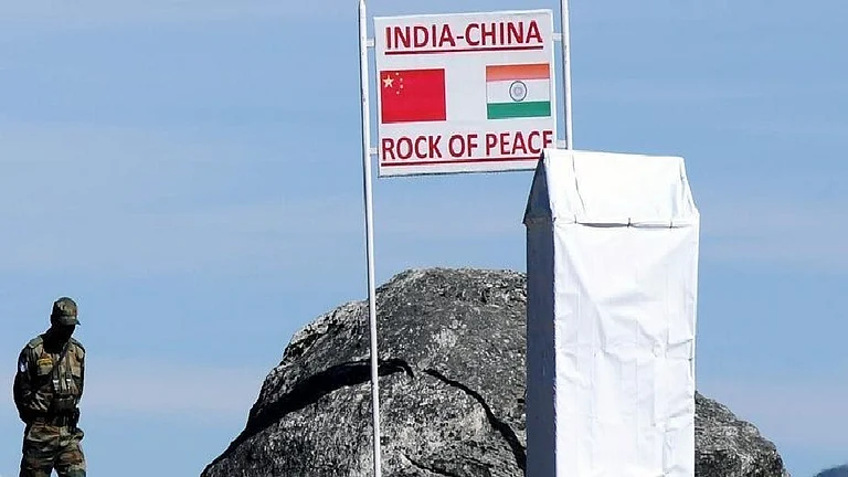
Several of the sites highlighted in the updated map are closely associated with India’s border history with China.
Thag La is particularly significant because of its connection with the opening phase of the 1962 India-China war. Its location near a sensitive portion of the eastern sector gives it continuing strategic relevance.
Longju is located along the Line of Actual Control and is associated with one of the early India-China border confrontations in 1959.
Jaswant Garh and the Sher-e-Thapa Memorial are linked to the memory of Indian resistance during the 1962 conflict.
Jairampur, meanwhile, carries strategic importance because of its connectivity towards eastern Arunachal Pradesh and the Myanmar frontier.
Some of these locations were already represented on Indian military maps, but they have now been formally standardised on the government’s political map.
Does The Update Change India’s Boundary?
The exercise does not redraw India’s borders or announce a new territorial claim.
Instead, it standardises the names and representation of specific places and geographical features within India’s existing official map of Arunachal Pradesh.
The government has described the objective primarily in terms of ensuring accurate recognition and improving public awareness.
However, because the changes involve locations close to a disputed frontier, the exercise also carries wider strategic significance.

Why Is The Timing Important?
The update comes as India and China continue efforts to stabilise bilateral relations while their boundary dispute remains unresolved.
The two countries recently held the 36th meeting of the Working Mechanism for Consultation and Coordination on India-China Border Affairs in New Delhi on August 6.
During the meeting, the two sides reviewed the border situation and discussed delimitation of the boundary, border management and trans-border cooperation. They also emphasised maintaining peace and tranquillity along the LAC as an important condition for improving the broader relationship.
The map revision also comes ahead of the BRICS Summit scheduled to be held in New Delhi on September 12-13, with Chinese President Xi Jinping expected to attend.
If Xi travels to India, it would be his first visit to the country since October 2019 and could provide another opportunity for engagement between Prime Minister Narendra Modi and the Chinese President.

How Does China View Arunachal Pradesh?
China continues to claim Arunachal Pradesh, referring to the state as “Zangnan” or “South Tibet”.
India has consistently rejected this position and maintained that Arunachal Pradesh is an integral and inalienable part of the country.
Beijing has also repeatedly issued lists assigning Chinese names to places in Arunachal Pradesh. It released six such names in 2017, 15 in 2021 and another 11 in 2023.
New Delhi has rejected these exercises, maintaining that assigning new names does not alter the status of Arunachal Pradesh as part of India.
Against this backdrop, the formal standardisation of Indian names on Survey of India maps gives greater official visibility to New Delhi’s existing territorial position.