Government of India has identified 28 places and geographical features in Ladakh on official Survey of India maps
The updated map has been published on the Survey of India website for public access and official use
The move comes amid the India-China border dispute along the Line of Actual Control in eastern Ladakh
India has formally identified 28 places and geographical features in Ladakh on official Survey of India maps. The move sharpens New Delhi’s assertion of territorial identity in the Union Territory amid the border dispute with China.
The step carries weight because China has, in recent years, put forward its own names for places in Arunachal Pradesh and other parts of the disputed India-China border. By adding the Ladakh names to official Indian maps, the government has moved them from a political response into the formal map record.
The government has now incorporated the names into the Survey of India map of Ladakh to ensure consistent recognition in official records and broader public awareness. The updated map is available on the Survey of India website.

Named Features Listed
The list spans a wide range of terrain. It covers peaks, mountains, passes, glaciers, valleys, rivers, lakes and other geographical features spread across Ladakh.
The peaks and mountains named are Atisha Giri, Kanishka Peak, Karun Pir, Martand Giri, Zorawar Peak, Drak Karpo, Rinchen Zangpo, Sakyasri Giri, Marpa Lotsava Ri, Milarepa Kangri, Shiva Ri and Maheshvara Ri.



The list also includes Chapchingal Pass and Shachmirk Pass, Parpik and Skamri glaciers, Shkorga Valley and Yangpa River. Guru Rinpoche has been identified as a lake, while several other locations have been classified as land areas.
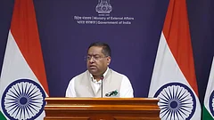
The government stated, "Government of India, in consultation with the Union Territory of Ladakh, has identified a total of twenty-eight (28) places/features, located in the UT of Ladakh, by standard place and feature names on the official map of Survey of India (SoI). Identifying them formally on the Survey of India map of UT of Ladakh is aimed at facilitating their accurate recognition and better awareness among the public at large."
Border Tensions Context
The move comes against a tense border backdrop. India and China remain locked in a dispute along the Line of Actual Control in eastern Ladakh.
China has announced its own names in recent years for places in Arunachal Pradesh and in areas it claims along the border region. India has rejected those exercises and maintained that assigning invented names does not change the status of territory.
This step is different. The names are not just part of a political response but are being entered into official Survey of India cartographic records, giving them formal standing in government mapping.
Cultural Significance Matters
Some of the names carry cultural and historical weight. Zorawar Peak refers to General Zorawar Singh’s campaigns in Ladakh, while Guru Rinpoche refers to the revered Buddhist master also known as Padmasambhava.
The public-facing element is clear as well. The Survey of India has published the updated map of Ladakh, including the additional features, on its official website.