Himalayan glaciers are losing ice at an accelerating rate, with ice loss reportedly doubling since 2000.
The Himalayan ecosystem underpins more than 20% of India’s GDP, making glacier loss a potential economic and water-security risk.
Nearly 200 high-risk glacial lakes in India, including 56 classified as very high risk, leave downstream populations vulnerable to GLOFs and other hazards.
The Himalayas are approaching a critical point as accelerating glacier loss threatens water security, livelihoods and economic activity across the region, with a new report warning that the mountain ecosystem underpins more than 20% of India’s GDP. The findings come as scientists warn that the Hindu Kush Himalaya is moving towards “peak water”, when river flows could eventually begin declining as glaciers lose their ice reserves.
The Ministry of Earth Sciences says Indian agencies have documented accelerated and heterogeneous mass loss in Himalayan glaciers. Government data also gives glacier retreat rates across the Indus, Ganga and Brahmaputra basins.
How Fast Are Himalayan Glaciers Melting?
Glaciers in the Hindu Kush Himalaya (HKH) region are losing ice at an increasingly rapid pace, with the rate of ice loss having doubled since 2000. The findings come from two major reports by the International Centre for Integrated Mountain Development (ICIMOD), which are scheduled for release on 21 March 2026, marking World Day for Glaciers.
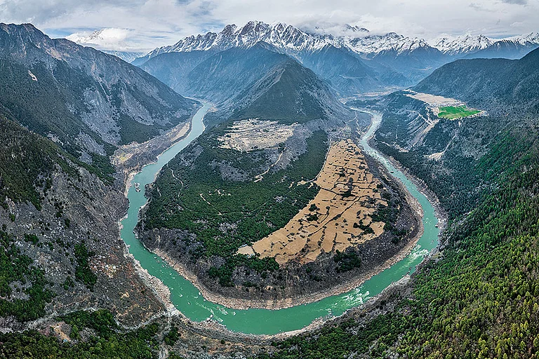
The reports, Changing Dynamics of Glaciers in the Hindu Kush Himalaya Region from 1990 to 2020 and HKH Glacier Outlook 2026: Insights from 50 Years of Himalayan Glacier Monitoring, offer extensive evidence on how glaciers in the region have changed over time. Their findings show that glaciers have lost up to 27 metres in ice thickness since 1975, raising concerns for the nearly two billion people living downstream who rely on meltwater from the region, often described as the ‘Water Towers of Asia’.


The problem is a changing water cycle: more melt/runoff initially, followed eventually by declining glacier contribution as ice reserves shrink.
Why Is India’s Economy At Risk?
Himalayan rivers support agriculture and populations far beyond the mountain states. India's own government has previously noted that glacier changes affect downstream water budgets, hydropower, flash floods, sedimentation and agricultural practices.
Various Indian institutes/universities/organizations (Geological Survey of India (GSI), Wadia Institute of Himalayan Geology (WIHG), National Centre for Polar and Ocean Research (NCPOR), National Institute of Hydrology (NIH), Space Application Centre (SAC), Indian Institute of Science (IISc) etc.) monitor Himalayan glaciers for various scientific studies including glacier melting and have reported accelerated heterogeneous mass loss in Himalayan glaciers, Ministry of Earth Sciences.
The University of Leeds reconstructed the size and ice surfaces of 14,798 Himalayan glaciers during the Little Ice Age, which was 400-700 years ago. The study concludes that the Himalayan glaciers have lost ice ten times more quickly over the last few decades than on average since the last major glacier expansion. In the last 400 to 700 years, the glaciers have lost around 40 per cent area – shrinking from 28,000 square kilometer (km2) to around 19,600 km2.
Melting glaciers have significant impact on water resources of Himalayan rivers due to change in glacier basin hydrology, downstream water budget, impact on hydropower plants due to variation in discharge, flash flood and sedimentation. They also increase in risk related to glacier hazards due to enhanced number and volume of glacier lakes, accelerated flash flood and Glacial Lake Outburst Floods (GLOFs), impact on agro practices in high Himalayan region etc.
What Happens If The Himalayas Reach A Tipping Point?
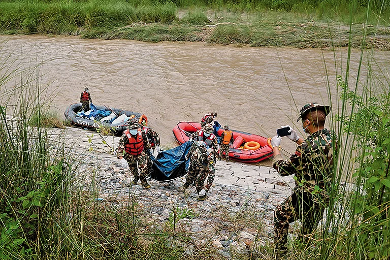
The Himalayas face the threat of a cascading disaster, where a single high-altitude calamity can trigger avalanches, block rivers and unleash flash floods, rapidly magnifying destruction downstream -- a danger laid bare by Nepal's recent catastrophe, a senior Geological Survey of India official told PTI.
Therefore, Himalayan hazards cannot be assessed in isolation, he pointed out and stressed the need for combining satellite-based observations with field investigations and ground instrumentation.
The flash floods near the Nepal-Tibet border on August 26 devastated towns and villages in northern and central Nepal. The Bhotekoshi river carried the floodwaters downstream, sweeping away homes, roads and bridges and killing more than 1,300 people.
Singh stressed the need to identify unstable mountain systems before they turn into catastrophic events.
"A single instability at high elevation can initiate a sequence involving an avalanche, landslide or glacier failure, river blockage, dam-break type release, debris flow and downstream flooding. Such processes can interact and amplify one another," he told PTI.
The geologist said the priority should be systematic scientific screening of potentially high-risk areas, particularly locations where a high-altitude failure could rapidly enter a river and affect populations and infrastructure downstream.
Close to 200 glacial lakes in India had been identified as high risk, with 56 classified as "very high risk", leaving millions exposed downstream, as per Reuters.
Glacial lakes are formed by melting glaciers accumulating in depressions on or near the glacier’s surface. Glacial Lake Outburst Floods occur when these lakes suddenly burst open due to factors such as excessive water accumulation or earthquakes. One such outburst in Sikkim in October 2023 resulted in at least 60 fatalities and extensive damage in four districts.
Singh said, "Satellite observations can potentially provide valuable precursor information, particularly where progressive deformation or acceleration occurs before failure. However, a detected increase in movement indicates that the particular slope is in distress; however, the failure will occur on reaching the limit equilibrium condition, which may be difficult to predict."
The answer lies in combining satellite-based observations with field investigations and ground instrumentation.