The Bay of Bengal has two cyclone peaks, around May and November, with the southwest monsoon suppressing storm formation between them.
Falling wind shear after the monsoon, warm surface waters and atmospheric moisture create favourable conditions for cyclones.
El Niño and intraseasonal atmospheric oscillations can influence cyclone activity, although neither determines whether an individual storm will form.
Why Bay Of Bengal Cyclones Come In Clusters: The Monsoon, Wind Patterns And El Niño
Three cyclones have struck India's eastern coast in less than four weeks, but the cluster reflects the Bay of Bengal's seasonal cyclone cycle, shaped by retreating monsoon winds, warm ocean waters, atmospheric oscillations and changing climate conditions

Summary
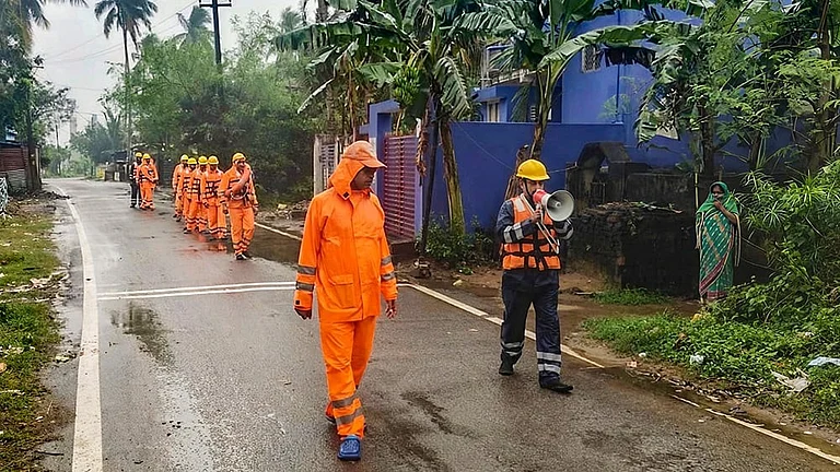
The Bay of Bengal has barely had time to settle between storms. Cyclone Arnab crossed the Andhra Pradesh coast near Yanam on October 28 as a very severe cyclonic storm. Murasu followed on November 3, making landfall near Ongole with winds of 100–110 kmph. Now, Cyclone Akvan has begun crossing the north Andhra Pradesh–south Odisha coast near Gopalpur. Three cyclones have struck India's eastern coastline in less than four weeks.
The sequence may look unusual, but the atmosphere has its own calendar — and November is when the Bay of Bengal becomes particularly hospitable to storms.
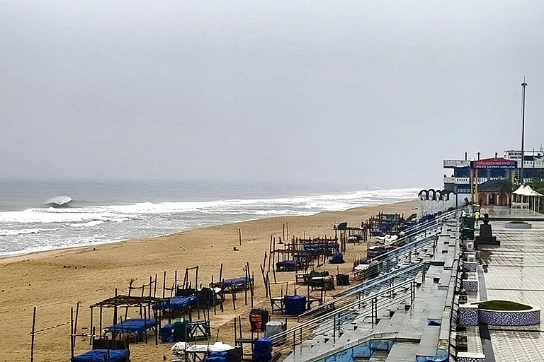
The North Indian Ocean has two cyclone peaks: one around May and another, usually stronger, in November. Between them lies the southwest monsoon, which changes the atmosphere so dramatically that conditions become hostile to organised cyclone formation. The result is a seasonal rhythm in which storms can emerge in clusters once the monsoon retreats and the atmosphere begins to favour their development.
Monsoon Creates A Window For Cyclones
A tropical cyclone needs more than warm seawater to take shape. The India Meteorological Department identifies several conditions: sea surface temperatures of at least 26.5°C extending to sufficient depth, moisture in the middle atmosphere, atmospheric instability, an existing low-pressure disturbance and enough rotation to organise the system. It also needs relatively weak vertical wind shear — the difference in wind speed and direction between lower and upper levels of the atmosphere. When that difference becomes too strong, it can tear apart the developing storm before it gathers strength.
This is where the southwest monsoon changes the equation. From June to September, strong westerly winds blow through the lower atmosphere, while powerful easterlies dominate at higher levels.
The resulting vertical wind shear disrupts the organisation of thunderstorms around developing systems. The Bay remains warm and humid, but the atmosphere becomes less conducive to cyclones. In other words, the fuel is available, but the conditions needed to turn a disturbance into a well-organised storm are missing.
Advertisement
As the monsoon withdraws, that protective disruption weakens. Wind shear falls, while the atmosphere retains much of the moisture accumulated during the rainy months. October and November therefore become favourable months for cyclogenesis — the formation of tropical cyclones.
A 2013 study published in the Journal of Climate found that the October-November improvement in cyclone-forming conditions was driven primarily by the decline in monsoon-related wind shear. The seasonal window reopens, and disturbances that might previously have weakened can begin to organise and intensify.
Why The Bay Of Bengal Gets More Storms
The Bay of Bengal produces roughly four times as many cyclones as the Arabian Sea, according to the IMD's climatological account. One reason is geography. Some storms that originate as typhoons over the western North Pacific move across the South China Sea and enter the Bay. The Arabian Sea does not receive an equivalent supply of systems from another major cyclone-producing basin. It is also relatively cooler, making conditions less favourable for storm development.
Advertisement
The Bay has another unusual advantage for developing storms. Rivers and monsoon rainfall pour freshwater into its northern reaches. This freshwater forms a relatively light surface layer over the saltier water beneath it.
Normally, strong cyclone winds churn the sea and bring colder subsurface water upwards, reducing the energy available to the storm. But the freshwater layer can limit that mixing, allowing warm water to remain near the surface. Research by scientists at the Indian Institute of Science has found that this can reduce the cooling effect of cyclones over the northern Bay, helping storms retain their energy.
The usual landfall pattern also shifts as the season progresses. October cyclones more frequently affect Odisha and West Bengal, while November systems tend to threaten Andhra Pradesh and, at times, Tamil Nadu. By December, the risk increasingly moves towards Tamil Nadu's coastline. This does not determine where every storm will travel, but it helps explain why the eastern coast faces different vulnerabilities as the post-monsoon season advances.
Advertisement

El Niño Puzzle And Why Storms Arrive Together
The recent cluster carries another complication: it has formed during a strong El Niño. The climate phenomenon involves unusually warm surface waters in the central and eastern equatorial Pacific, thousands of kilometres from India. Its influence, however, extends through atmospheric circulation, changing rainfall patterns, winds and conditions over distant ocean basins. The US National Oceanic and Atmospheric Administration's Climate Prediction Center said on November 12 that El Niño was strengthening and that strong-to-very-strong conditions were likely to persist through January-March 2027.
Research has often associated El Niño years with less favourable conditions for post-monsoon cyclones over the Bay of Bengal, including weaker low-level rotation and reduced ocean heat content. A 2026 study by researchers from India's National Centre for Ocean Information Services and Andhra University also found that La Niña conditions generally produce a more favourable environment for cyclone formation than El Niño. But these are statistical relationships, not rules that prevent cyclones from forming during an El Niño year.
Advertisement
Storms can also arrive in clusters because of intraseasonal atmospheric oscillations — large bands of cloud, rainfall and circulation that travel across tropical regions over several weeks. A 2010 study by researchers at the University of Hawaii found that around 60 per cent of tropical cyclones in the North Indian Ocean formed in association with significant intraseasonal oscillation events. One of these patterns is the Madden-Julian Oscillation, which can temporarily make atmospheric conditions more favourable for cyclone development.
Three storms in four weeks, then, do not necessarily signal that the Bay of Bengal has entered an entirely new cyclone regime. They reflect a seasonal window, shifting winds, ocean conditions and atmospheric patterns interacting over time. The monsoon may have withdrawn from the coastline, but its influence remains suspended over the sea — shaping when the next storm can gather, and where it may eventually come ashore.
Published At: