Nepal’s devastating floods have renewed scrutiny of the risks of major infrastructure in the fragile Himalayas.
China’s Brahmaputra mega dam is being built in a seismically active region near India’s Arunachal Pradesh. Seismic risks include earthquakes, landslides and cascading hazards in tectonically active region
Chinese geologists identify active Paizhen Fault beneath proposed mega dam site. India has formally conveyed concerns, urging transparency and downstream safeguards
Outlook Explains | Why Nepal’s Flash Floods Have Put China’s Brahmaputra Dam In Focus
Nepal’s devastating floods have renewed scrutiny of the risks posed by mega infrastructure in the fragile and seismically active Himalayas

Summary
Summary
The devastating floods along the Nepal-Tibet border have once again highlighted the extreme geological and hydrological risks of building major infrastructure in the Himalayas. The disaster, triggered by a massive ice-rock and glacial collapse, has also brought renewed attention to China's planned mega hydropower project on the Yarlung Tsangpo, which becomes the Brahmaputra as it enters India.
The South China Morning Post citing a recent study by researchers from Chengdu University of Technology and affiliated Chinese geological institutions, reported that the Paizhen Fault remains tectonically active and could continue generating earthquakes and related geological hazards.
The report has shifted attention from the dam's geopolitical implications to a more fundamental question: how safe is it to construct the world's largest hydropower project in one of the most seismically active regions on Earth?
The geological findings also arrive as India continues to press China for greater transparency over the project. New Delhi has repeatedly urged Beijing to ensure that upstream activities do not adversely affect downstream countries, while maintaining that its interests as a lower riparian state must be protected.

Why Is The Project So Significant
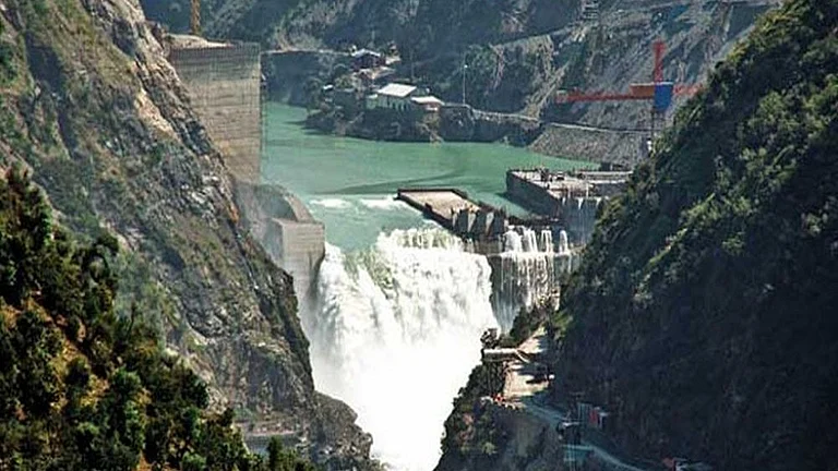
The proposed hydropower project is being built on the lower reaches of the Yarlung Tsangpo in Tibet, just before the river enters India as the Brahmaputra. The river then flows through Arunachal Pradesh and Assam before reaching Bangladesh, sustaining millions of people through agriculture, drinking water, fisheries and ecosystems.
Chinese authorities have described the project as a strategic national undertaking aimed at strengthening energy security, supporting regional development and advancing the country's carbon reduction goals. Premier Li Qiang attended the groundbreaking ceremony in July 2025, with state media portraying the project as a milestone in China's clean energy transition.
Once completed, the facility is expected to become the world's largest hydropower station, surpassing the Three Gorges Dam in installed generating capacity. Its location within the Yarlung Tsangpo Grand Canyon, where the river drops dramatically over a relatively short distance offers enormous hydropower potential but also presents exceptional engineering challenges.
Advertisement
What Have Chinese Geologists Reportedly Found
The Chinese research identified the Paizhen Fault as an active geological structure beneath or near the proposed project site. The researchers reportedly concluded that the fault has experienced repeated movement since the Late Pleistocene and remains capable of generating future seismic activity.
The reported findings also highlight broader geological hazards associated with the region, including landslides, slope instability and rockfalls, secondary events that often accompany large earthquakes in mountainous terrain.
While the findings do not suggest that construction should be abandoned, they indicate that geological conditions will require careful assessment throughout the project's design, construction and operation.
Does An Active Fault Mean The Dam Is Unsafe
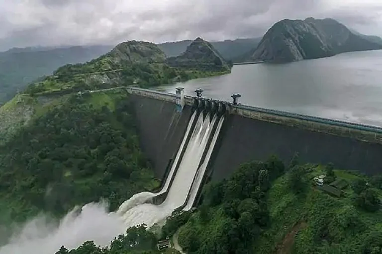
Many of the world's largest dams have been constructed in earthquake-prone regions. Modern engineering allows large concrete structures to withstand significant seismic forces through specialised foundations, flexible structural designs, continuous monitoring systems and extensive geological investigations before construction begins.
Advertisement
However, building in a seismically active environment inevitably increases engineering complexity.
Engineers must account not only for earthquake shaking but also for permanent ground movement, slope failures, debris flows and the possibility of cascading natural hazards. In mountainous regions such as the eastern Himalayas, a single earthquake can trigger multiple landslides that block rivers, alter drainage patterns and create temporary lakes capable of causing destructive floods if they suddenly collapse.
The lower Yarlung Tsangpo valley is already recognised as one of the most geologically dynamic landscapes in Asia because of the ongoing collision between the Indian and Eurasian tectonic plates. That tectonic activity created the Himalayas and continues to shape the region today.
Why Is India Concerned
India's concerns over the project predate the latest geological report. Responding to a question in the Rajya Sabha, Minister of State for External Affairs Kirti Vardhan Singh said India had formally conveyed its concerns to China after Beijing approved the hydropower project. The government issued a diplomatic demarche on December 30, 2024, urging China to ensure that the interests of downstream states are not adversely affected.
Advertisement
The Ministry of External Affairs said India has consistently called upon China to maintain transparency, consult downstream countries and safeguard the established rights of lower riparian states. It added that New Delhi continues to closely monitor developments relating to the Brahmaputra and has taken preventive as well as corrective measures to protect the lives and livelihoods of people living downstream.
The issue has also featured in bilateral discussions between the two countries. During Foreign Secretary Vikram Misri's visit to Beijing, India and China agreed to convene an early meeting of the Expert Level Mechanism on transboundary rivers to discuss hydrological data sharing and broader river cooperation.
Does The Geological Warning Change The Debate
Until now, most discussion surrounding the mega dam has focused on water security, ecological impacts, sediment transport and the strategic implications of upstream infrastructure on a transboundary river.
Advertisement
The reported geological findings introduce another dimension. Rather than questioning the project's purpose, they raise questions about how seismic risk, fault movement and geological instability are being incorporated into the design of what is expected to become the world's largest hydropower facility.
China has not publicly responded to the geological findings, nor has it released detailed engineering assessments for independent scrutiny. Official statements continue to emphasise the project's economic, environmental and energy benefits.
For India, however, the issue is broader than engineering alone. Any major infrastructure project on the upper reaches of the Brahmaputra carries implications for downstream disaster preparedness, emergency coordination and long-term river management. The latest geological warning therefore adds to, rather than replaces, the existing strategic and environmental concerns surrounding the project.
Where Things Stand
Construction of the hydropower project is continuing, with Beijing presenting it as a cornerstone of its long-term energy strategy. India, meanwhile, has maintained its preference for sustained diplomatic engagement, reiterating that upstream activities should not harm downstream interests and that transparency remains essential.
Whether the geological findings ultimately influence the project's design, operational safeguards or bilateral discussions remains unclear. What is evident is that the world's largest hydropower project is now being assessed not only through the lenses of energy security and geopolitics, but also through the realities of building critical infrastructure in one of the planet's most active tectonic landscapes.
Published At: