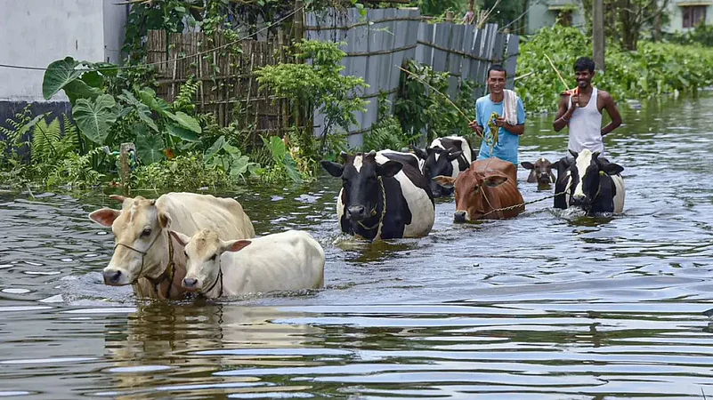
Floods are annually recurring natural hazards in northeast India, where the main brunt is borne by Assam. In the last seven decades (1951-2022), there was not a single year when the state didn’t experience flooding. However, over the years the floods have become more widespread and more ferocious, inflicting bigger losses and damage to the state’s economy, agriculture and infrastructure, with human suffering also soaring all over. The state experienced catastrophic floods in the years 1951, 1968, 1972, 1987, 1988, 1998,2004, 2008, 2012 and most recently in 2019. Observing what has already happened in the month of May and June, the year 2022 is shaping up to become one of those megaflood years for the state.
Advertisement
Also Read | Assam Floods 2022: The Water May Dry, But The Tears Won't
Assam and its neighbouring states received very high rainfall in the pre-monsoon and monsoon seasons so far. During the month of June (June 1-30, 2022), the first month of the monsoon season, the Meteorological Sub Divisions (MSD) of Arunachal Pradesh received 32 per cent excess rainfall, while Assam & Meghalaya MSD got 76 per cent excess rainfall, compared to the long-term average for the month of June. During the same period, the state of Arunachal received excess rainfall of 32 per cent, while Assam and Meghalaya received excess rainfall of 61 per cent and 107 per cent respectively. Most of the largely affected districts were also lashed with a large excess of rainfall, for example, Baksa (104%), Barpeta (105%), Bongaigaon (105%), Chirang (171%), Udalguri (75%), Dhubri (65%), Goalpara (70%), Kokrajhar (97%), Nalbari (116%), Kamrup Rural (88%), Lakhimpur (76%), Dhemaji (138%), Cachar (69%), and Karimganj (104%).
It is to be noted that Assam had already suffered from unusually devastating pre-monsoon floods in the month of May this year. It received 40 per cent above normal rainfall in the pre-monsoon season (March-May) of 2022. Its neighbouring state, Meghalaya recorded a 93 per cent excess rainfall. This episode of heavy downpour led to the devastating floods that swept the Barak Valley, the hill districts of Dima Hasao, East Karbi Anglong and West Karbi Anglong and southern parts of Assam, mainly the districts of Nagaon and Hojai in the second and fourth week of May. The copious rainfall and pre-monsoon floods occurring in many districts of the state make the soil saturated with moisture and the occurrence of heavy rainfall immediately after in the early monsoon season, in June, made it easy for the rainfall to be largely converted to river run-off of huge volumes.
Advertisement
Also Read | Assam Floods 2022: Diary From Silchar
Such excessive rainfall and calamitous floods affecting almost the entire state at the same time are not uncommon in the history of the state. However, observing the trends of rainfall in the last two decades and the projections that indicate the possibility of extreme rains occurring more frequently and all over the NE region, the excessive June rains and the early monsoon flood mayhem could well have had the signature of climate change impact.
However, non-climatic factors also play an important role in making floods more intense, frequent, and damaging as observed in recent years. For example, many of our rivers are losing water carrying capacity due to increased bed-siltation which is caused by accelerated soil erosion from both upper catchment areas lying within the state as well as in the neighbouring states as well as Bhutan, a neighbouring country. The heavy sediment load borne by our rivers can be ascribed to natural factors like the fragile geologic and geomorphic structure of the Eastern Himalayas prone to high seismicity, landslides as well as anthropogenic factors like deforestation in the river catchments and faulty land-use practices. Channel congestion due to some of the structural measures and encroachments on the core flood plain and breaching of embankments also increase flood hazards. Unwarranted release of water from river dams also creates flood havoc in downstream areas, which is common in some districts of Assam. Lack of proper drainage structures and networks in a predominantly low-lying flood plain area is also an abettor of flood inundation and intensity, a factor which is usually not much attended to by the concerned authorities.
Also Read | What Is Causing Unprecedented Floods In Assam? Climate Change Or Sloppy Management?
The present approach to flood management is dominated by structural measures like embankments. Embankments, when designed, constructed, and maintained properly protect some areas for a long time. However, many of the embankments collapse prematurely due to faulty design, shoddy construction, and ill maintenance. Breaching in embankments makes floods more devastating than those that occur in absence of embankments. Embankments are impromptu and temporary responses to floods. It is high time we look beyond embankments and contemplate introducing innovative technology by learning from success stories abroad and adaptive innovation by local scientists and engineers. A non-structural approach like flood forecasting and flood warning must encompass all tributaries besides the two main rivers, e.g., Brahmaputra and the Barak and must be disseminated to the last mile vulnerable person so that loss and damage can be minimised through strengthening preparedness. The current ‘impact and response’ strategy needs to be transformed into a resilience-focused approach integrating sustainable river management with disaster risk mitigation.
Advertisement
In Pics: Assam Flood Situation Improves, But Nearly 14 Lakh People Still Affected
The need of the hour is to adopt an integrated flood and erosion management policy and develop a long-term action plan specifically for the state of Assam to mitigate the twin disaster of flood and erosion. We need a comprehensive action plan that brings in the best of innovative science and technology applicable to our region and suggests short-term, mid-term and long-term measures for addressing the problem, accounting for the ecological fragility, climate change impact and social vulnerability of the people. A task force may be constituted incorporating international, national, and local experts for developing the action plan. The Central and State Governments must show a willingness to invest the required financial resources for providing a durable solution to the problem.
(The rainfall figures are from the India Meteorological Department’s website)
Advertisement
The writer is an environmental scientist working for Aaranyak (www.aaranyak.org), an environmental research organisation based in Guwahati, having research interest on water-induced hazards, climate change and water governance.