Overcast skies, gusty winds and light rain are predicted to bring relief from the punishing heat in Delhi in the second half of the day on Wednesday, the India Meteorological Department (IMD) said.
The Safdarjung Observatory, Delhi's primary weather station, recorded a minimum temperature of 25.4 degrees Celsius, a notch below normal. The maximum temperature is likely to settle around 39 degrees Celsius.
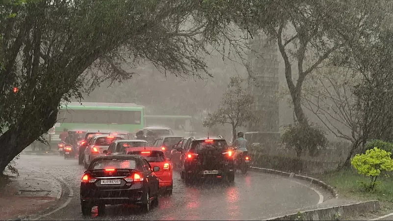
Under the influence of a western disturbance active over the western Himalayan region, thunderstorms and intermittent rains are predicted in northwest India, including the capital and its surrounding areas over the next two to three days.
Advertisement
This will bring the maximum temperature down to 35 degrees Celsius on Thursday. Below-normal maximum temperatures are predicted until June 30. A heat wave scorched parts of Delhi on Tuesday with seven of the 22 weather stations in the national capital recording maximum temperatures above the 45-degrees Celsius mark.
The heat sent the peak power demand in Delhi up to 6,916 MW on Tuesday, the highest so far this season, officials said. The city had recorded a peak power demand of 7,695 MW last summer and this year it might reach 8,100 MW, they said. The maximum temperature at a few places, including Najafgarh (46.7 degrees Celsius), breached the 46-degree mark for the second consecutive day on Tuesday.
Advertisement
The Safdarjung Observatory recorded a maximum temperature of 43.5 degrees Celsius -- three notches above normal. The mercury had soared to 45.1 degrees Celsius at Ridge in central Delhi, 45.2 degrees at Jafarpur, 45.2 degrees at Narela, 46.1 degrees at Pitampura, 45.7 degrees at Pusa, and 46.2 degrees at Sports Complex.
The threshold for a heat wave is met when the maximum temperature of a station reaches at least 40 degrees Celsius in the plains, 37 degrees in the coastal areas, and 30 degrees in the hilly regions, and the departure from normal is at least 4.5 degrees. Earlier this month, the weather office had predicted below-normal maximum temperatures and fewer heatwave days in northwest India in May.
With the IMD anticipating a slight delay in the arrival of the southwest monsoon, the maximum temperatures are likely to remain above normal for a longer-than-usual period. Heat waves in India are becoming more frequent and severe due to climate change, with over 90 per cent of the country in the "extremely cautious" category or "danger zone" of their impacts, according to a study conducted at the University of Cambridge.
The study also revealed that Delhi is particularly vulnerable to severe heatwave impacts despite its recent state action plan for climate change failing to reflect this fact.